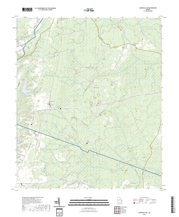
2024 Map of Glennville NE
USGS Topo · Published 2024About this map
Fort Stewart dominates the central and northern reaches of this coastal plain landscape, where the boundary between Tattnall, Liberty, and Long counties meets. This area is characterized by a dense network of blackwater drainages and wetlands, including the meandering paths of Taylors Creek and Kirkland Creek. The map reveals a pattern of dispersed rural heritage, preserved primarily through its numerous burial grounds. From Poplar Head Cem near the center to Little Rock Cem in the south, these sites often serve as the only remaining markers of early community clusters. Tuty Crossing stands out as a named point of interest within the military reservation, while the local road network, including Walthourville Rd and Anderson Way, connects these quiet woodlands to the surrounding region.
Find a feature on this map
36 named features on this map. Tap any name to fly to it.
Don’t see what you’re looking for? This feature index may not catch every label — zoom into the map to look around manually.
Map Details
Editions of this 2024 Glennville NE Map
This is the sole edition of this map. No revisions or reprints were ever made.
Other maps of this area

1918 · Hinesville
USGS Topo · 1:62,500

1919 · Claxton
USGS Topo · 1:62,500

1920 · Pembroke
USGS Topo · 1:62,500

1920 · Glennville
USGS Topo · 1:62,500

1944 · Claxton
USGS Topo · 1:62,500

1944 · Glennville
USGS Topo · 1:62,500

1944 · Hinesville
USGS Topo · 1:62,500

1946 · Brunswick
USGS Topo · 1:250,000

1947 · Savannah
USGS Topo · 1:250,000

1948 · Brunswick
USGS Topo · 1:250,000