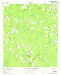
1958 Map of Glennville SE
USGS Topo · Published 1976About this map
Jones Creek and its many tributaries, including Little Jones Creek, Doctor Creek, and Old Millhead Branch, carve a dense drainage network across this portion of Southeast Georgia. This landscape is defined by the rural community life of the mid-20th century, centered on numerous country churches like Macedonia Ch, Poplar Head Ch, and Saint Thomas Ch. The settlement pattern follows small crossroads such as Donald and Smiley Crossroads, where local families established homes and cemeteries, including the Macedonia Cem. In the southern reaches, the Fletcher Branch Lookout Tower stands as a sentinel over the low-lying timberlands near Vinzant Swamp and Dry Branch. These revisions, captured in the late 1950s and updated in the 1970s, document a region where the natural hydrology of the coastal plain dictated the placement of roads and small inland hamlets.
Find a feature on this map
19 named features on this map. Tap any name to fly to it.
Don’t see what you’re looking for? This feature index may not catch every label — zoom into the map to look around manually.
Map Details
Editions of this 1958 Glennville SE Map
2 editions found
Other maps of this area

1918 · Jesup
USGS Topo · 1:62,500

1918 · Hinesville
USGS Topo · 1:62,500

1920 · Glennville
USGS Topo · 1:62,500

1943 · Ludowici
USGS Topo · 1:62,500

1943 · Jesup
USGS Topo · 1:62,500

1944 · Glennville
USGS Topo · 1:62,500

1944 · Hinesville
USGS Topo · 1:62,500

1946 · Brunswick
USGS Topo · 1:250,000

1948 · Brunswick
USGS Topo · 1:250,000

1950 · Glennville
USGS Topo · 1:62,500