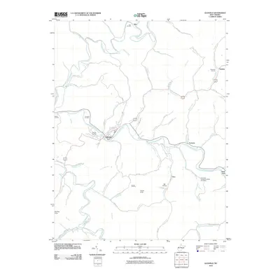
2010 Map of Glenville
USGS Topo · Published 2010About this map
The Little Kanawha River dictates the settlement patterns of this Gilmer County landscape, winding through a valley that connects the population centers of Glenville and Sand Fork. As of 2010, the regional infrastructure relies on the river’s path, with River St and various county routes tracking the water's edge. Higher elevations like Tank Hill and Powell Knob overlook a dense network of runs and creeks, such as Leading Creek and Stewart Creek, which have carved deep hollows into the terrain.
Find a feature on this map
78 named features on this map. Tap any name to fly to it.
Don’t see what you’re looking for? This feature index may not catch every label — zoom into the map to look around manually.
Map Details
Editions of this 2010 Glenville Map
This is the sole edition of this map. No revisions or reprints were ever made.
Other maps of this area

1893 · Sutton
USGS Topo · 1:125,000

1904 · Vadis
USGS Topo · 1:62,500

1906 · Holbrook
USGS Topo · 1:62,500

1906 · Glenville
USGS Topo · 1:62,500

1906 · Burnsville
USGS Topo · 1:62,500

1924 · Holbrook
USGS Topo · 1:62,500

1925 · Glenville
USGS Topo · 1:62,500

1925 · Burnsville
USGS Topo · 1:62,500

1925 · Vadis
USGS Topo · 1:62,500

1926 · Holbrook
USGS Topo · 1:62,500