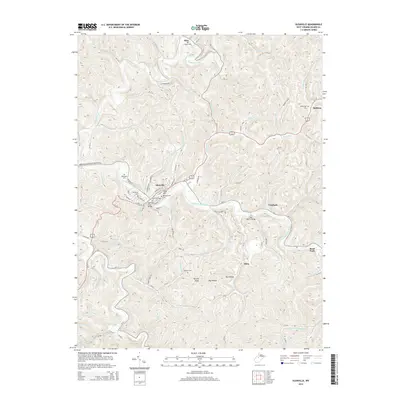
2014 Map of Glenville
USGS Topo · Published 2014About this map
The Little Kanawha River winds through the heart of Gilmer County, anchoring the town of Glenville where the historic Glenville Truss Bridge crosses the water. This 2014 survey captures the local seat of learning at Glenville State College, positioned near the elevation of Tank Hill. The landscape is defined by a dense network of runs and creeks, including Cedar Creek and Leading Creek, that have carved deep hollows such as Big Hollow into the central West Virginia hills. Smaller communities like Alice, Baldwin, and Sand Fork serve as regional landmarks along the winding routes of Us-119 and WV-5. For genealogists, the map identifies numerous family and community burial grounds, from the Old Glenville Cemetery to the more remote Messenger Cemetery and Rhodes Cemetery, providing a precise record of the area's established burial sites and ancestral settlements.
Find a feature on this map
100 named features on this map. Tap any name to fly to it.
Don’t see what you’re looking for? This feature index may not catch every label — zoom into the map to look around manually.
Map Details
Editions of this 2014 Glenville Map
This is the sole edition of this map. No revisions or reprints were ever made.
Other maps of this area

1893 · Sutton
USGS Topo · 1:125,000

1904 · Vadis
USGS Topo · 1:62,500

1906 · Holbrook
USGS Topo · 1:62,500

1906 · Glenville
USGS Topo · 1:62,500

1906 · Burnsville
USGS Topo · 1:62,500

1924 · Holbrook
USGS Topo · 1:62,500

1925 · Glenville
USGS Topo · 1:62,500

1925 · Burnsville
USGS Topo · 1:62,500

1925 · Vadis
USGS Topo · 1:62,500

1926 · Holbrook
USGS Topo · 1:62,500