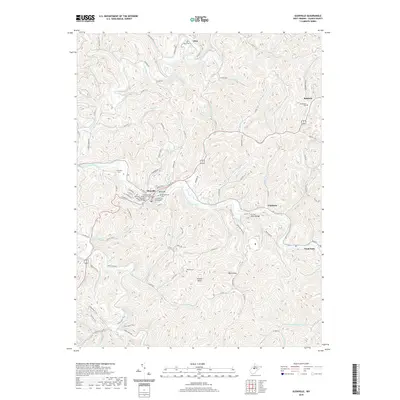
2019 Map of Glenville
USGS Topo · Published 2019About this map
The Little Kanawha River winds through this central West Virginia landscape, anchoring the development of Glenville and surrounding settlements like Sand Fork and Alice. This area is characterized by a dense network of runs and creeks, including Leading Creek and Cedar Creek, which have carved the deep hollows and high points like Tank Hill and Powell Knob. As the county seat, Glenville serves as a civic center, home to the Gilmer County Courthouse and the Glenville Truss Bridge. Genealogists will find a wealth of burial sites throughout the valleys, from the Old Glenville Cem and Stalnaker Cem near the river to more remote locations like Rhodes Cem and Messenger Cem. The terrain is also marked by numerous trails, such as the Fishermen's Trail and Park View Trail, suggesting a modern landscape intertwined with its longstanding river-valley roots.
Find a feature on this map
89 named features on this map. Tap any name to fly to it.
Don’t see what you’re looking for? This feature index may not catch every label — zoom into the map to look around manually.
Map Details
Editions of this 2019 Glenville Map
This is the sole edition of this map. No revisions or reprints were ever made.
Other maps of this area

1893 · Sutton
USGS Topo · 1:125,000

1904 · Vadis
USGS Topo · 1:62,500

1906 · Holbrook
USGS Topo · 1:62,500

1906 · Glenville
USGS Topo · 1:62,500

1906 · Burnsville
USGS Topo · 1:62,500

1924 · Holbrook
USGS Topo · 1:62,500

1925 · Glenville
USGS Topo · 1:62,500

1925 · Burnsville
USGS Topo · 1:62,500

1925 · Vadis
USGS Topo · 1:62,500

1926 · Holbrook
USGS Topo · 1:62,500