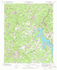
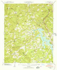
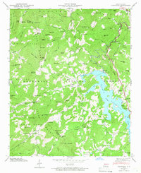
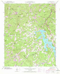
1946 Map of Glenville
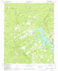
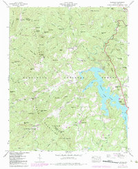
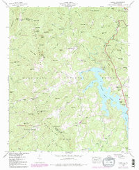
USGS Topo · Published 1970About this map
Thorpe Reservoir (Lake Glenville) dominates this mountain landscape, a high-altitude water body created by the Glenville Dam. The map, reflecting a 1946 field examination with later 1967 revisions, captures the rugged boundary between Jackson and Macon Counties. Significant electrical infrastructure is evident along the Tuckasegee River, including the Tuckasegee Power Plant and a nearby Surge Tank.
Find a feature on this map
89 named features on this map. Tap any name to fly to it.
Don’t see what you’re looking for? This feature index may not catch every label — zoom into the map to look around manually.
Map Details
Editions of this 1946 Glenville Map
7 editions found
Other maps of this area

1891 · Cowee
USGS Topo · 1:125,000

1897 · Cowee
USGS Topo · 1:125,000

1907 · Cowee
USGS Topo · 1:125,000

1933 · Bryson
USGS Topo · 1:62,500

1935 · Cashiers
USGS Topo · 1:24,000

1935 · Tuckaseigee
USGS Topo · 1:24,000

1935 · Cullowhee
USGS Topo · 1:24,000

1935 · Scaly
USGS Topo · 1:24,000

1935 · Glenville
USGS Topo · 1:24,000

1935 · Corbin Knob
USGS Topo · 1:24,000