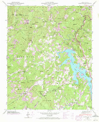
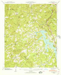
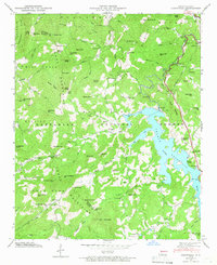
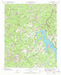
1946 Map of Glenville
USGS Topo · Published 1972About this map
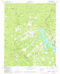
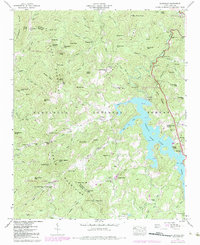
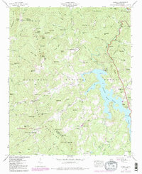
Thorpe (Reservoir) Lake dominates the eastern half of this terrain, created by the Glenville Dam along the West Fork Tuckasegee River. This mid-century survey illustrates the highland landscape where the Cowee Mountains and Ellijay Mountains meet, much of which is protected within the Nantahala National Forest. The map documents numerous small communities and family-named clusters that existed near the water's edge and along the steep ridges, including Erastus, Glenville, Hamburg, and Shookville.
Find a feature on this map
90 named features on this map. Tap any name to fly to it.
Don’t see what you’re looking for? This feature index may not catch every label — zoom into the map to look around manually.
Map Details
Editions of this 1946 Glenville Map
7 editions found
Other maps of this area

1891 · Cowee
USGS Topo · 1:125,000

1897 · Cowee
USGS Topo · 1:125,000

1907 · Cowee
USGS Topo · 1:125,000

1933 · Bryson
USGS Topo · 1:62,500

1935 · Cashiers
USGS Topo · 1:24,000

1935 · Tuckaseigee
USGS Topo · 1:24,000

1935 · Cullowhee
USGS Topo · 1:24,000

1935 · Scaly
USGS Topo · 1:24,000

1935 · Glenville
USGS Topo · 1:24,000

1935 · Corbin Knob
USGS Topo · 1:24,000