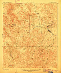
1902 Map of Globe
USGS Topo · Published 1910About this map
Globe serves as the focal point of this copper-rich territory at the dawn of the twentieth century, anchored by the substantial Old Dominion Mine and a cluster of surrounding workings like the Copper Hill Mine and Buffalo Mine. The landscape is defined by the massive Pinal Mountains, where Pinal Peak towers over a network of canyons and gulches. Infrastructure is driven by mineral extraction, as evidenced by the G. V. G. & N. R. R. rail line and the established Bloody Tanks Base Line. Outside the mining camps, the map reveals a rugged ranching economy through named holdings such as Pinal Ranch, Sixtysix Ranch, and Schultze Ranch. This survey captures the transition from isolated territorial outposts to an industrial mining district, punctuated by vital water sources like Big Eds Well and Continental Spring.
Find a feature on this map
59 named features on this map. Tap any name to fly to it.
Don’t see what you’re looking for? This feature index may not catch every label — zoom into the map to look around manually.
Map Details
Editions of this 1902 Globe Map
3 editions found
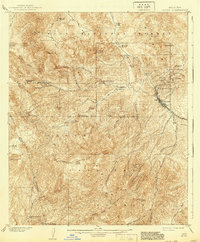
Other maps of this area

1900 · Florence
USGS Topo · 1:125,000

1901 · Globe
USGS Topo · 1:62,500

1902 · Globe
USGS Topo · 1:62,500

1902 · Florence
USGS Topo · 1:125,000

1907 · Roosevelt
USGS Topo · 1:125,000

1909 · Four Peaks
USGS Topo · 1:125,000

1910 · Ray
USGS Topo · 1:62,500

1912 · Roosevelt
USGS Topo · 1:125,000

1915 · Christmas
USGS Topo · 1:62,500

1917 · Christmas
USGS Topo · 1:62,500