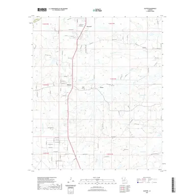
2020 Map of Gloster
USGS Topo · Published 2020About this map
Stonewall and the surrounding DeSoto Parish landscape are defined by a network of rural settlements and family-associated landmarks. This area showcases a traditional southern settlement pattern where community life centered around small churches and their adjacent burial grounds, such as Saint Ann Church Cem and Morning Star Church Cem. The geography is shaped by watercourses like Sand Bayou and Edwards Bayou, which navigate the terrain between Gloster and the community of Kickapoo. A distinct residential character emerges in the south, where roads like Appaloosa Dr and Buckskin Dr suggest a more modern equestrian or suburban influence transitioning into the deeper woods. The presence of the Grand Cane Firetower Rd and the Fire Tower Rd near the southern boundary reflects the region's managed timberlands and the ongoing importance of forest fire surveillance in this part of Louisiana.
Find a feature on this map
72 named features on this map. Tap any name to fly to it.
Don’t see what you’re looking for? This feature index may not catch every label — zoom into the map to look around manually.
Map Details
Editions of this 2020 Gloster Map
This is the sole edition of this map. No revisions or reprints were ever made.
Other maps of this area

1945 · Grand Cane
USGS Topo · 1:62,500

1945 · Greenwood
USGS Topo · 1:62,500

1945 · Mansfield
USGS Topo · 1:62,500

1947 · Mansfield
USGS Topo · 1:62,500

1948 · Caspiana
USGS Topo · 1:62,500

1955 · Shreveport
USGS Topo · 1:250,000

1955 · Caspiana
USGS Topo · 1:62,500

1955 · Greenwood
USGS Topo · 1:62,500

1956 · Shreveport
USGS Topo · 1:250,000
1957 · Grand Cane
USGS Topo · 1:62,500