
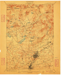
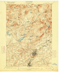
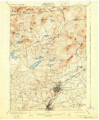
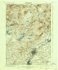
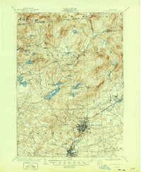
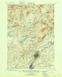
1903 Map of Gloversville
USGS Topo · Published 1903About this map
Gloversville and Johnstown serve as the primary industrial and commercial hubs in this early twentieth-century survey of Fulton County. The grid-like street patterns of these twin cities contrast sharply with the sprawling lake country and timbered highlands to the north. A significant technological feature of the era is the Fonda Johnstown and Gloversville Electric R.R., which provided a vital transportation link between the industrial centers and smaller outlying settlements like Kingsboro and Mayfield.
Find a feature on this map
66 named features on this map. Tap any name to fly to it.
Don’t see what you’re looking for? This feature index may not catch every label — zoom into the map to look around manually.
Map Details
Editions of this 1903 Gloversville Map
8 editions found

Other maps of this area

1895 · Amsterdam
USGS Topo · 1:62,500

1896 · Fonda
USGS Topo · 1:62,500

1898 · Fonda
USGS Topo · 1:62,500

1898 · Canajoharie
USGS Topo · 1:62,500

1899 · Broadalbin
USGS Topo · 1:62,500

1900 · Canajoharie
USGS Topo · 1:62,500

1901 · Lassellsville
USGS Topo · 1:62,500

1902 · Broadalbin
USGS Topo · 1:62,500

1902 · Canajoharie
USGS Topo · 1:62,500

1902 · Fonda
USGS Topo · 1:62,500