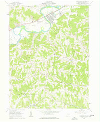
1962 Map of Gnadenhutten
USGS Topo · Published 1963About this map
The Tuscarawas River carves a deep valley through this portion of Tuscarawas County, dictating the settlement patterns and industrial infrastructure of the early 1960s. The village of Gnadenhutten sits on the river's northern bend, anchored by the Pennsylvania railroad and the Gnadenhutten Monument (Cemetery). This area reveals a landscape in transition, where traditional small-town life at Seventeen and Gilmore exists alongside an expanding extractive economy, evidenced by numerous Strip Mines, Kilns, and Gravel Pits dotting the hillsides. The map is a rich resource for genealogists, detailing several country churches like Frys Valley Ch and West Union Ch, as well as family and community landmarks such as Brown Cem and Rush Sch. Moving south from the river, the terrain becomes increasingly complex, with Murphy Hollow and Pleasant Valley cutting through the uplands near the Grange Hall.
Find a feature on this map
45 named features on this map. Tap any name to fly to it.
Don’t see what you’re looking for? This feature index may not catch every label — zoom into the map to look around manually.
Map Details
Editions of this 1962 Gnadenhutten Map
4 editions found
Other maps of this area

1909 · Antrim
USGS Topo · 1:48,000

1909 · Uhrichsville
USGS Topo · 1:62,500

1909 · Cambridge
USGS Topo · 1:62,500

1911 · Antrim
USGS Topo · 1:62,500

1911 · Uhrichsville
USGS Topo · 1:62,500

1911 · Newcomerstown
USGS Topo · 1:62,500

1912 · Cambridge
USGS Topo · 1:62,500

1913 · Newcomerstown
USGS Topo · 1:62,500

1943 · Newcomerstown
USGS Topo · 1:62,500

1951 · Canton
USGS Topo · 1:250,000