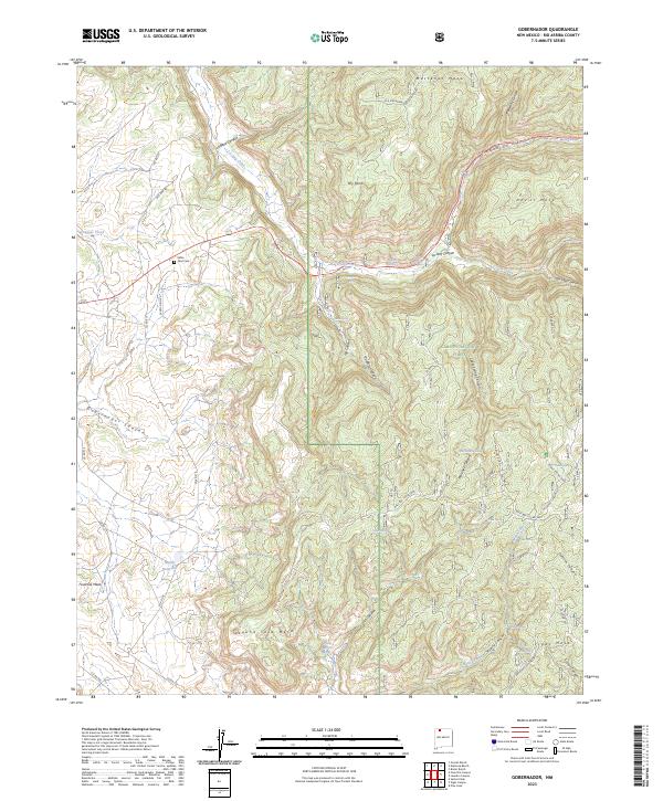
2023 Map of Gobernador
USGS Topo · Published 2023About this map
Gobernador Canyon and the high plateaus of Mestenas Mesa define this portion of Rio Arriba County, where the high desert terrain is punctuated by isolated ranchsteads and seasonal water sources. The map provides a look at modern land use within the Carson National Forest, documenting family-named locations such as Gomez Ranch, Espinosa Ranch, and Bixler Ranch. These sites, along with the Santa Nino Cem near Old Hwy 64, offer important markers for genealogists and local historians tracking the legacy of Spanish and American settlement in the region.
Find a feature on this map
57 named features on this map. Tap any name to fly to it.
Don’t see what you’re looking for? This feature index may not catch every label — zoom into the map to look around manually.
Map Details
Editions of this 2023 Gobernador Map
This is the sole edition of this map. No revisions or reprints were ever made.
Other maps of this area

1889 · Largo
USGS Topo · 1:250,000

1895 · Largo
USGS Topo · 1:250,000

1954 · Gomez Ranch
USGS Topo · 1:24,000

1954 · Aztec
USGS Topo · 1:250,000

1958 · Aztec
USGS Topo · 1:250,000

1962 · Aztec
USGS Topo · 1:250,000

1963 · Fourmile Canyon
USGS Topo · 1:24,000
1963 · Espinosa Ranch
USGS Topo · 1:24,000

1963 · Gobernador
USGS Topo · 1:24,000
1963 · Pine Lake
USGS Topo · 1:24,000