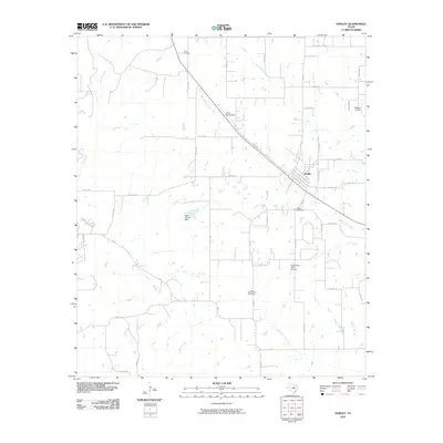
2010 Map of Godley
USGS Topo · Published 2010About this map
Godley serves as the central hub of this North Texas landscape, where the intersection of FM 2331 and FM 917 anchors a community defined by its agrarian roots and aviation infrastructure. The town is flanked by historic burial grounds, including the Godley Cemetery and Unity Cemetery to the north, while the southern reaches feature the Lone Cottonwood Cemetery. The map reveals a high concentration of private aviation sites such as Aresti Aerodrome, Hawkins Airport, and Coppenger Farm Airport, reflecting the region's flat, open terrain and specialized land use.
Find a feature on this map
45 named features on this map. Tap any name to fly to it.
Don’t see what you’re looking for? This feature index may not catch every label — zoom into the map to look around manually.
Map Details
Editions of this 2010 Godley Map
This is the sole edition of this map. No revisions or reprints were ever made.
Other maps of this area

1889 · Granbury
USGS Topo · 1:125,000

1891 · Weatherford
USGS Topo · 1:125,000

1891 · Cleburne
USGS Topo · 1:125,000

1893 · Weatherford
USGS Topo · 1:125,000

1894 · Cleburne
USGS Topo · 1:125,000

1894 · Fort Worth
USGS Topo · 1:125,000

1923 · Granbury 1-b
USGS Topo · 1:48,000

1924 · Granbury 1-c
USGS Topo · 1:48,000

1928 · Godley
USGS Topo · 1:62,500

1954 · Dallas
USGS Topo · 1:250,000