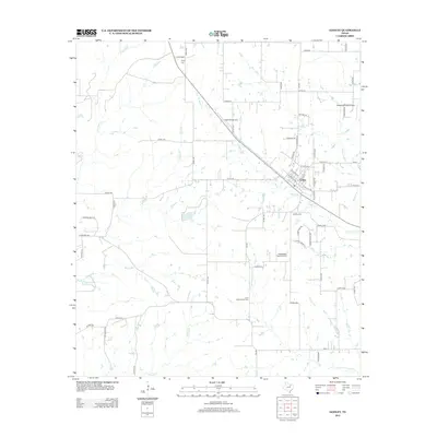
2012 Map of Godley
USGS Topo · Published 2012About this map
The town of Godley serves as the focal point for this Johnson County landscape, where the prairie begins its transition toward the Brazos River valley. As of 2012, the community retains its rural character, anchored by historic sites such as Godley Cem and the more remote Lone Cottonwood Cem and Unity Cem. The area is notably defined by its hydrology, with the Nolan River and several of its tributaries, including W Nolan Cr and Wilson Cr, carving through the countryside. This era shows a distinctive blend of traditional agriculture and private aviation, with facilities like the Aresti Aerodrome, Hawkins Private Airport, and Coppenger Farm Airport scattered among the farmsteads. Local land use is further illustrated by reservoirs and ranch features such as Lake Charca and the Ellaine Grande Ranch Lake, indicating the importance of water management in this part of North Texas.
Find a feature on this map
66 named features on this map. Tap any name to fly to it.
Don’t see what you’re looking for? This feature index may not catch every label — zoom into the map to look around manually.
Map Details
Editions of this 2012 Godley Map
This is the sole edition of this map. No revisions or reprints were ever made.
Other maps of this area

1889 · Granbury
USGS Topo · 1:125,000

1891 · Weatherford
USGS Topo · 1:125,000

1891 · Cleburne
USGS Topo · 1:125,000

1893 · Weatherford
USGS Topo · 1:125,000

1894 · Cleburne
USGS Topo · 1:125,000

1894 · Fort Worth
USGS Topo · 1:125,000

1923 · Granbury 1-b
USGS Topo · 1:48,000

1924 · Granbury 1-c
USGS Topo · 1:48,000

1928 · Godley
USGS Topo · 1:62,500

1954 · Dallas
USGS Topo · 1:250,000