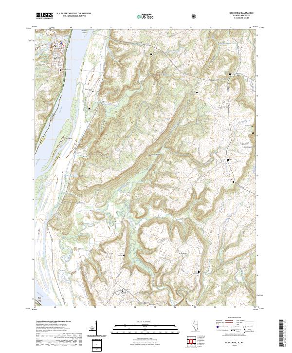
2024 Map of Golconda
USGS Topo · Published 2024About this map
The Pope County Courthouse stands as the central landmark of Golconda, situated on the northern banks of the Ohio River. This riverfront landscape is defined by its deep history of settlement and transit, where the waters divide Illinois and Kentucky. Moving inland, the terrain rises into the timbered ridges of the Shawnee National Forest, punctuated by significant geological formations like Mantle Rock and Newmans Bluff. A dense network of family and community burial grounds, including the Odd Fellows Cem and McMurray Chapel Cem, is scattered across the uplands, tracing the genealogy of the river-facing communities. The river itself remains the dominant feature, containing large landforms such as Pryor Island and Rondeau Island that have historically shaped navigation and local land use along this stretch of the border.
Find a feature on this map
70 named features on this map. Tap any name to fly to it.
Don’t see what you’re looking for? This feature index may not catch every label — zoom into the map to look around manually.
Map Details
Editions of this 2024 Golconda Map
This is the sole edition of this map. No revisions or reprints were ever made.
Other maps of this area

1916 · Golconda
USGS Topo · 1:62,500

1917 · Brownfield
USGS Topo · 1:62,500

1920 · Goloonda
USGS Topo · 1:48,000

1921 · Golconda
USGS Topo · 1:62,500

1926 · Paducah
USGS Topo · 1:62,500

1929 · Smithland
USGS Topo · 1:62,500

1929 · Paducah
USGS Topo · 1:62,500

1936 · Smithland
USGS Topo · 1:48,000

1940 · Paducah
USGS Topo · 1:62,500
1942 · Smithland
USGS Topo · 1:62,500