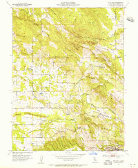
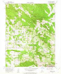
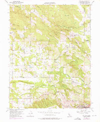
1954 Map of Gold Hill
USGS Topo · Published 1955About this map
Virginiatown and the nearby Gold Hill settlement center this mid-century survey of Placer County, capturing a landscape defined by its hydraulic and mining history. The complex network of water infrastructure, including the Camp Far West Ditch, Whisky Canal, and Doty Canal, illustrates the intensive management of local waterways like Coon Creek and Orr Creek for both agriculture and industry. To the south, the Southern Pacific railroad runs through Newcastle, while the presence of Dredge Tailings near the Lincoln Road serves as a physical reminder of the region's extractive past.
Find a feature on this map
35 named features on this map. Tap any name to fly to it.
Don’t see what you’re looking for? This feature index may not catch every label — zoom into the map to look around manually.
Map Details
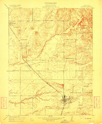
Editions of this 1954 Gold Hill Map
4 editions found

Other maps of this area

1888 · Smartsville
USGS Topo · 1:125,000

1891 · Sacramento
USGS Topo · 1:125,000

1891 · Smartsville
USGS Topo · 1:125,000

1892 · Sacramento
USGS Topo · 1:125,000

1892 · Smartsville
USGS Topo · 1:125,000

1893 · Sacramento
USGS Topo · 1:125,000

1894 · Smartsville
USGS Topo · 1:125,000

1895 · Smartsville
USGS Topo · 1:125,000
1910 · Lincoln
USGS Topo · 1:31,680

1910 · Roseville
USGS Topo · 1:31,680