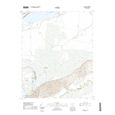
2019 Map of Golddust
USGS Topo · Published 2019About this map
The Mississippi River dominates this riverfront landscape, shaping a complex network of chutes, bars, and sloughs along the Tennessee-Arkansas border. The settlement of Golddust sits near the riverbank, protected by a system of levees and bounded by Crutcher Lake Rd. This area is defined by its shifting hydrology, where features like The Chute and Old River suggest the historical migration of the main channel. To the south, the terrain rises sharply at Chickasaw Bluff Number One, a significant geological landmark overlooking the bottomlands.
Find a feature on this map
57 named features on this map. Tap any name to fly to it.
Don’t see what you’re looking for? This feature index may not catch every label — zoom into the map to look around manually.
Map Details
Editions of this 2019 Golddust Map
This is the sole edition of this map. No revisions or reprints were ever made.
Other maps of this area

1939 · Hales Point
USGS Topo · 1:62,500

1939 · Blytheville
USGS Topo · 1:62,500

1952 · Hales Point
USGS Topo · 1:62,500

1955 · Blytheville
USGS Topo · 1:62,500

1956 · Blytheville
USGS Topo · 1:250,000

1959 · Blytheville
USGS Topo · 1:250,000

1961 · Hales Point
USGS Topo · 1:62,500

1961 · Rialto
USGS Topo · 1:62,500

1962 · Rialto
USGS Topo · 1:62,500

1962 · Hales Point
USGS Topo · 1:62,500