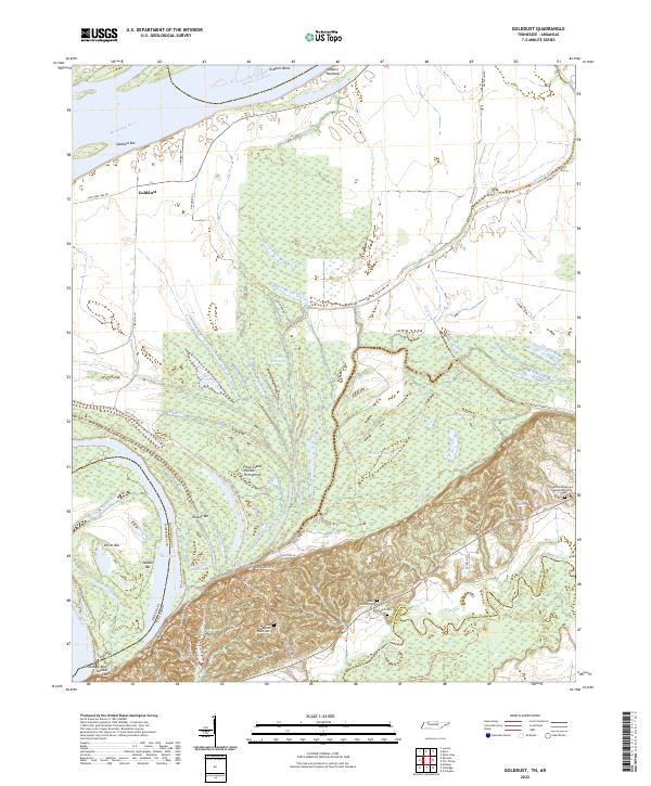
2022 Map of Golddust
USGS Topo · Published 2022About this map
The Mississippi River creates a dynamic western boundary for Lauderdale County, defining a landscape of complex waterways and shifting bars like Golddust Bar and Yankee Bar. Near the settlement of Golddust, the terrain transitions from river-level sloughs to the prominent rise of Chickasaw Bluff Number One. This area preserves several family and community landmarks, including the Bates Family Cem and the Oak Grove Baptist Church Cem situated along the winding backroads.
Find a feature on this map
49 named features on this map. Tap any name to fly to it.
Don’t see what you’re looking for? This feature index may not catch every label — zoom into the map to look around manually.
Map Details
Editions of this 2022 Golddust Map
This is the sole edition of this map. No revisions or reprints were ever made.
Other maps of this area

1939 · Hales Point
USGS Topo · 1:62,500

1939 · Blytheville
USGS Topo · 1:62,500

1952 · Hales Point
USGS Topo · 1:62,500

1955 · Blytheville
USGS Topo · 1:62,500

1956 · Blytheville
USGS Topo · 1:250,000

1959 · Blytheville
USGS Topo · 1:250,000

1961 · Hales Point
USGS Topo · 1:62,500

1961 · Rialto
USGS Topo · 1:62,500

1962 · Rialto
USGS Topo · 1:62,500

1962 · Hales Point
USGS Topo · 1:62,500