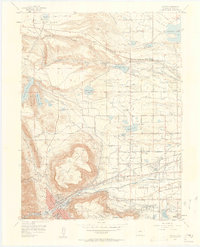
1957 Map of Golden
USGS Topo · Published 1958About this map
The massive volcanic plateaus of North Table Mountain and South Table Mountain dominate this mid-century view, flanking the northern reaches of Golden. At the base of these mesas, the landscape transitions from the academic halls of the Colorado School of Mines to the industrial activity of numerous Clay Pits and Gravel Pits. Water management is central to the area's development, evidenced by an intricate network of canals and ditches serving reservoirs like Standley Lake, Leyden Lake, and Ralston Reservoir.
Find a feature on this map
52 named features on this map. Tap any name to fly to it.
Don’t see what you’re looking for? This feature index may not catch every label — zoom into the map to look around manually.
Map Details
Editions of this 1957 Golden Map
3 editions found
Other maps of this area

1899 · West Denver
USGS Topo · 1:125,000

1906 · Blackhawk
USGS Topo · 1:62,500

1938 · Morrison
USGS Topo · 1:24,000

1939 · Golden
USGS Topo · 1:24,000

1940 · Lafayette
USGS Topo · 1:31,680

1941 · Arvada
USGS Topo · 1:31,680

1941 · Fort Logan
USGS Topo · 1:31,680

1942 · Eldorado Springs
USGS Topo · 1:24,000

1942 · Morrison
USGS Topo · 1:31,680

1942 · Golden
USGS Topo · 1:31,680