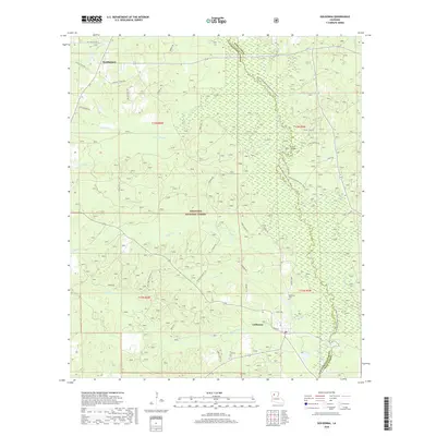
2018 Map of Goldonna
USGS Topo · Published 2018About this map
Goldonna and the surrounding piney woods of Kisatchie National Forest anchor this portion of the Louisiana interior. The landscape is defined by the winding course of Saline Bayou, which forms the boundary between Natchitoches and Winn Parishes. This waterway serves as a recreational corridor, featuring the Saline Bayou Canoe Trail (Water) and the Saline Bayou Foot Trail that track its banks. To the north, the small settlement of Readheimer sits near the headwaters of Eightmile Cr.
Find a feature on this map
41 named features on this map. Tap any name to fly to it.
Don’t see what you’re looking for? This feature index may not catch every label — zoom into the map to look around manually.
Map Details
Editions of this 2018 Goldonna Map
This is the sole edition of this map. No revisions or reprints were ever made.
Other maps of this area

1937 · Campti NE
USGS Topo · 1:31,680

1944 · Campti
USGS Topo · 1:62,500

1947 · Goldonna
USGS Topo · 1:62,500

1947 · Ashland
USGS Topo · 1:62,500

1948 · Campti
USGS Topo · 1:62,500

1949 · Calvin NE
USGS Topo · 1:31,680

1949 · Calvin NW
USGS Topo · 1:31,680

1953 · Alexandria
USGS Topo · 1:250,000

1955 · Shreveport
USGS Topo · 1:250,000

1955 · Alexandria
USGS Topo · 1:250,000