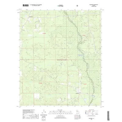
2020 Map of Goldonna
USGS Topo · Published 2020About this map
Goldonna and the northern reaches of the Kisatchie National Forest anchor this 2020 landscape where Natchitoches and Winn Parishes meet. The settlement of Readheimer stands in the northwest, connected to the surrounding countryside by a network of local routes including Strange Church Rd and Bill Blalock Rd. The topography is defined by the winding course of the Saline Bayou Wild and Scenic River, which serves as a natural parish boundary. Recreational and ecological corridors are well-marked, from the Saline Bayou Canoe Trail following the water to the Saline Bayou Foot Trail threading through the woods. Numerous tributaries such as Choctaw Cr, Malaudos Cr, and Ragan Cr drain into the bayou, illustrating the complex hydrology of this forested region. Near Goldonna, local landmarks like the Goldonna Cem and the Cloud Bridge area provide specific points of interest for genealogical and local history research.
Find a feature on this map
41 named features on this map. Tap any name to fly to it.
Don’t see what you’re looking for? This feature index may not catch every label — zoom into the map to look around manually.
Map Details
Editions of this 2020 Goldonna Map
This is the sole edition of this map. No revisions or reprints were ever made.
Other maps of this area

1937 · Campti NE
USGS Topo · 1:31,680

1944 · Campti
USGS Topo · 1:62,500

1947 · Goldonna
USGS Topo · 1:62,500

1947 · Ashland
USGS Topo · 1:62,500

1948 · Campti
USGS Topo · 1:62,500

1949 · Calvin NE
USGS Topo · 1:31,680

1949 · Calvin NW
USGS Topo · 1:31,680

1953 · Alexandria
USGS Topo · 1:250,000

1955 · Shreveport
USGS Topo · 1:250,000

1955 · Alexandria
USGS Topo · 1:250,000