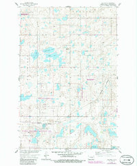
1958 Map of Goldwin
USGS Topo · Published 1986About this map
Glacial prairie potholes define this Stutsman County landscape, where numerous lakes and wetlands are protected by the extensive National Waterfowl Production Area. The small settlement of Goldwin serves as a focal point along the Burlington Northern railroad, surrounded by large townships like Conklin, Glacier, and Wadsworth.
Find a feature on this map
20 named features on this map. Tap any name to fly to it.
Don’t see what you’re looking for? This feature index may not catch every label — zoom into the map to look around manually.
Map Details
Editions of this 1958 Goldwin Map
2 editions found
Other maps of this area

1948 · Carrington
USGS Topo · 1:62,500

1950 · Melville
USGS Topo · 1:24,000

1950 · Carrington SW
USGS Topo · 1:24,000

1952 · New Rockford
USGS Topo · 1:250,000

1956 · New Rockford
USGS Topo · 1:250,000
1958 · Vashti
USGS Topo · 1:24,000
1958 · Goldwin SE
USGS Topo · 1:24,000
1958 · Goldwin SW
USGS Topo · 1:24,000

1958 · Goldwin
USGS Topo · 1:24,000

1971 · New Rockford
USGS Topo · 1:250,000