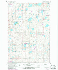
1958 Map of Goldwin SW
USGS Topo · Published 1986About this map
Glacial prairie potholes and scattered rural institutions define this mid-century landscape in Stutsman County. The terrain is characterized by a dense network of water bodies, including Eric Lake, Fischer Lake, and Spring Lake, alongside the partially dried East Fischer Lakebed. These wetlands are largely preserved within several tracts of the National Waterfowl Production Area, reflecting the region's importance to migratory bird conservation. Settlement is sparse, concentrated at isolated sites like School No 1 and religious landmarks such as Medina Ch and the Reformed Cem. The map reveals the rectilinear grid of the Missouri River Basin development era, where unimproved roads connect remote farms across the townships of Paris, Valley Spring, and Strong.
Find a feature on this map
16 named features on this map. Tap any name to fly to it.
Don’t see what you’re looking for? This feature index may not catch every label — zoom into the map to look around manually.
Map Details
Editions of this 1958 Goldwin SW Map
2 editions found
Other maps of this area

1952 · New Rockford
USGS Topo · 1:250,000

1953 · Jamestown
USGS Topo · 1:250,000

1953 · Cleveland
USGS Topo · 1:24,000

1954 · Cleveland NW
USGS Topo · 1:24,000

1954 · Medina
USGS Topo · 1:24,000

1956 · New Rockford
USGS Topo · 1:250,000

1956 · Jamestown
USGS Topo · 1:250,000
1958 · Vashti
USGS Topo · 1:24,000
1958 · Goldwin SE
USGS Topo · 1:24,000
1958 · Goldwin SW
USGS Topo · 1:24,000