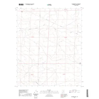
2023 Map of Golondrina Well
USGS Topo · Published 2023About this map
Hines Draw and Hackberry Draw carve through this arid stretch of Lincoln County, defining a landscape where water management is essential for survival. The presence of Dead Mexican Tank, Rainbow Tank, and Pipeline Tank indicates a sophisticated network of localized water catchment and storage, likely supporting livestock or small-scale ranching operations. The terrain is further shaped by Hasperos Canyon and Little Hasperos Canyon, which cut through the high desert plateaus.
Find a feature on this map
19 named features on this map. Tap any name to fly to it.
Don’t see what you’re looking for? This feature index may not catch every label — zoom into the map to look around manually.
Map Details
Editions of this 2023 Golondrina Well Map
This is the sole edition of this map. No revisions or reprints were ever made.
Other maps of this area

1954 · Fort Sumner
USGS Topo · 1:250,000

1955 · Roswell
USGS Topo · 1:250,000

1958 · Fort Sumner
USGS Topo · 1:250,000

1958 · Roswell
USGS Topo · 1:250,000

1962 · Roswell
USGS Topo · 1:250,000

1980 · Corona
USGS Topo · 1:100,000
1981 · Pedernal Arroyo
USGS Topo · 1:24,000

1981 · Huff Hill
USGS Topo · 1:24,000

1981 · Cowboy Mesa SW
USGS Topo · 1:24,000
1981 · Juan Largo Canyon West
USGS Topo · 1:24,000