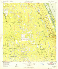
1949 Map of Gomez
USGS Topo · Published 1949About this map
Hanson Grant and Gomez Grant define the historical land division of this coastal Florida landscape during the late 1940s. The region is characterized by a complex network of wetlands and small lakes west of the Florida East Coast rail line, which serves as a primary corridor for the communities of Gomez and Hobe Sound. To the east, the barrier island of Jupiter Island separates the Intracoastal Waterway and Peck Lake from the Atlantic Ocean. The presence of an Underground Telephone Line and an Airway Beacon underscores the post-war infrastructure development occurring alongside natural features like the South Fork St Lucie River. In the southern reaches, the map details the early footprint of Jupiter State Park, offering a look at the preserved coastal terrain before the height of modern development.
Find a feature on this map
19 named features on this map. Tap any name to fly to it.
Don’t see what you’re looking for? This feature index may not catch every label — zoom into the map to look around manually.
Map Details
Editions of this 1949 Gomez Map
2 editions found
Other maps of this area

1948 · Palm City
USGS Topo · 1:24,000

1948 · Rood
USGS Topo · 1:24,000

1948 · St. Lucie Inlet
USGS Topo · 1:24,000

1948 · Gomez
USGS Topo · 1:24,000

1948 · Hobe Sound
USGS Topo · 1:24,000

1948 · Jupiter
USGS Topo · 1:24,000

1949 · Rood
USGS Topo · 1:24,000

1949 · Gomez
USGS Topo · 1:24,000

1949 · Hobe Sound
USGS Topo · 1:24,000

1950 · St. Lucie Inlet
USGS Topo · 1:24,000