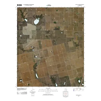
2010 Map of Gooch Lake
USGS Topo · Published 2010About this map
Gooch Lake and the neighboring Saleh Lake anchor the northern reaches of this Dawson County landscape, where the flat Texas High Plains are defined by a rigid grid of ranch and farm roads. The small settlement of Grandview stands near the western edge, serving as a focal point in a territory largely dedicated to agriculture and oil development. The road network is a mixture of state-maintained routes like Fm 2053 and locally named corridors such as Co Rd 1.8 Woodward and Glider Rd. This pattern of land use reflects the systematic surveying of the Llano Estacado, where ephemeral lakes and intermittent drainages provide the only variation in an otherwise geometric layout of fields and property lines.
Find a feature on this map
19 named features on this map. Tap any name to fly to it.
Don’t see what you’re looking for? This feature index may not catch every label — zoom into the map to look around manually.
Map Details
Editions of this 2010 Gooch Lake Map
This is the sole edition of this map. No revisions or reprints were ever made.
Other maps of this area

1954 · Lubbock
USGS Topo · 1:250,000

1954 · Hobbs
USGS Topo · 1:250,000

1954 · Big Spring
USGS Topo · 1:250,000

1954 · Brownfield
USGS Topo · 1:250,000

1958 · Brownfield
USGS Topo · 1:250,000

1958 · Big Spring
USGS Topo · 1:250,000

1958 · Hobbs
USGS Topo · 1:250,000

1962 · Brownfield
USGS Topo · 1:250,000

1968 · Lamesa North
USGS Topo · 1:24,000

1968 · Hancock
USGS Topo · 1:24,000