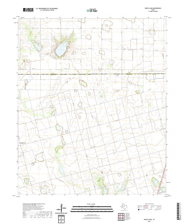
2022 Map of Gooch Lake
USGS Topo · Published 2022About this map
Gooch Lake and Saleh Lake form a distinct hydrologic heart for this landscape along the border of Lynn and Dawson counties. The terrain is defined by the high plains transition, where the grid of rural roads such as Co RD 36 and FM 2053 dissects a largely agricultural expanse. The small settlement of Grandview anchors the western edge of the sheet, connected by Ranch Rd 179.
Find a feature on this map
23 named features on this map. Tap any name to fly to it.
Don’t see what you’re looking for? This feature index may not catch every label — zoom into the map to look around manually.
Map Details
Editions of this 2022 Gooch Lake Map
This is the sole edition of this map. No revisions or reprints were ever made.
Other maps of this area

1954 · Lubbock
USGS Topo · 1:250,000

1954 · Hobbs
USGS Topo · 1:250,000

1954 · Big Spring
USGS Topo · 1:250,000

1954 · Brownfield
USGS Topo · 1:250,000

1958 · Brownfield
USGS Topo · 1:250,000

1958 · Big Spring
USGS Topo · 1:250,000

1958 · Hobbs
USGS Topo · 1:250,000

1962 · Brownfield
USGS Topo · 1:250,000

1968 · Lamesa North
USGS Topo · 1:24,000

1968 · Hancock
USGS Topo · 1:24,000