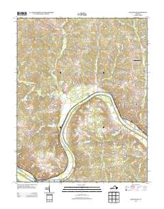
2013 Map of Goochland
USGS Topo · Published 2013About this map
The James River defines the southern boundary of this central Virginia landscape, where traditional rural estates meet modern residential clusters near the county seat. The area around Goochland shows a transition toward suburban development in neighborhoods like Village Acres and Venice Heights, while the surrounding territory remains deeply agricultural. Landmarks such as the Rose Retreat Farm Airport and Michaux Bridge highlight the local transportation network, alongside historic crossroads like Maidens and Michaux. North of the river, the terrain is shaped by numerous tributaries including Big Lickinghole Cr and Little Cr, which feed into various man-made water bodies like Fairfield Pond and Kelona Farm Pond. This 2013 survey provides a clear view of how long-established settlements like Sandy Hook and Rock Castle persist amidst a changing rural-to-suburban landscape.
Find a feature on this map
81 named features on this map. Tap any name to fly to it.
Don’t see what you’re looking for? This feature index may not catch every label — zoom into the map to look around manually.
Map Details
Editions of this 2013 Goochland Map
This is the sole edition of this map. No revisions or reprints were ever made.
Other maps of this area

1890 · Goochland
USGS Topo · 1:125,000

1891 · Palmyra
USGS Topo · 1:125,000

1892 · Goochland
USGS Topo · 1:125,000

1895 · Palmyra
USGS Topo · 1:125,000

1897 · Palmyra
USGS Topo · 1:125,000

1943 · Goochland
USGS Topo · 1:31,680

1943 · Fine Creek Mills
USGS Topo · 1:31,680

1943 · Powhatan
USGS Topo · 1:31,680

1943 · Perkinsville
USGS Topo · 1:31,680

1943 · South Anna
USGS Topo · 1:24,000