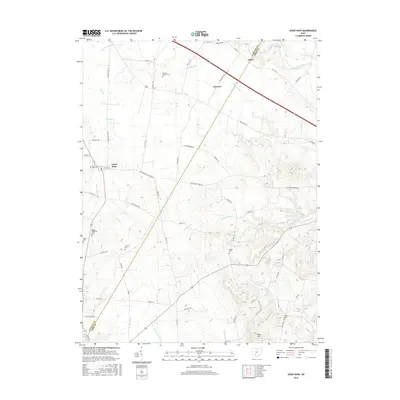
2016 Map of Good Hope
USGS Topo · Published 2016About this map
The Fayette and Ross County line bisects this agricultural landscape, where small crossroads communities like Good Hope and Plano serve as anchors for the surrounding farmsteads. The terrain transitions from the relatively flat plains near Indian Creek to the more dissected, stream-cut valleys in the southeast near Slate Hill. Genealogists will find a high density of small family and community burial sites scattered across the township, including the Eyeman-Bryant Cemetery, Stuckey Cemetery, and Rogers McElwain Cemetery. The drainage patterns are well-defined by numerous waterways such as Buckskin Creek and McCortney Run, which have influenced the local road network. The layout of the modern thoroughfares, including Old US Hwy 35 and Miami Trace Road, largely follows the historical property lines and stream valleys that have defined this rural Ohio region for generations.
Find a feature on this map
69 named features on this map. Tap any name to fly to it.
Don’t see what you’re looking for? This feature index may not catch every label — zoom into the map to look around manually.
Map Details
Editions of this 2016 Good Hope Map
This is the sole edition of this map. No revisions or reprints were ever made.
Other maps of this area

1906 · Mt Sterling
USGS Topo · 1:62,500

1911 · Era
USGS Topo · 1:62,500

1912 · Roxabell
USGS Topo · 1:62,500

1913 · Era
USGS Topo · 1:62,500

1914 · Roxabell
USGS Topo · 1:62,500

1917 · Greenfield
USGS Topo · 1:62,500

1943 · Era
USGS Topo · 1:62,500

1944 · Greenfield
USGS Topo · 1:62,500

1944 · Roxabell
USGS Topo · 1:62,500

1947 · Columbus
USGS Topo · 1:250,000