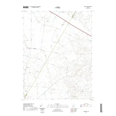
2019 Map of Good Hope
USGS Topo · Published 2019About this map
Good Hope and Fairview anchor this agricultural landscape along the border of Fayette and Ross Counties. The terrain is defined by a dense network of small waterways, including Indian Cr and Whetstone Run, which carve through the rural acreage towards the North Fork Paint Creek. The settlement pattern reflects deep-rooted family ties to the land, evidenced by numerous small burial grounds such as Eyeman-Bryant Cem and Rogers McElwain Cem found tucked away from the primary thoroughfares. To the south, the topography shifts near Slate Hill, where the drainage of Buckskin Cr and its various forks creates a more complex relief. Modern transit corridors like Mills Rd SE and Washington Good Hope Rd overlay an older network of township roads, preserving the spatial layout of these farming communities as they appeared in the early 21st century.
Find a feature on this map
71 named features on this map. Tap any name to fly to it.
Don’t see what you’re looking for? This feature index may not catch every label — zoom into the map to look around manually.
Map Details
Editions of this 2019 Good Hope Map
This is the sole edition of this map. No revisions or reprints were ever made.
Other maps of this area

1906 · Mt Sterling
USGS Topo · 1:62,500

1911 · Era
USGS Topo · 1:62,500

1912 · Roxabell
USGS Topo · 1:62,500

1913 · Era
USGS Topo · 1:62,500

1914 · Roxabell
USGS Topo · 1:62,500

1917 · Greenfield
USGS Topo · 1:62,500

1943 · Era
USGS Topo · 1:62,500

1944 · Greenfield
USGS Topo · 1:62,500

1944 · Roxabell
USGS Topo · 1:62,500

1947 · Columbus
USGS Topo · 1:250,000