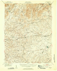
1950 Map of Goode
USGS Topo · Published 1952About this map
The rolling Piedmont landscape of Bedford County and Campbell County is defined here by the crossing of the Norfolk and Western railway and a dense network of historic community landmarks. Poplar Forest stands as a primary feature in the east, while the New London Academy highlights the institutional history of the New London area. The topography is anchored by No Business Mountain and Fleming Mountain in the north, with the Big Otter River and Elk Creek draining the southern valleys. Dozens of rural churches and schools, such as Timber Ridge Ch and Hutter Sch, appear alongside small settlements like Goode and Lowry, documenting the social fabric of mid-century central Virginia before modern suburban expansion transformed the outskirts of the nearby city.
Find a feature on this map
97 named features on this map. Tap any name to fly to it.
Don’t see what you’re looking for? This feature index may not catch every label — zoom into the map to look around manually.
Map Details
Editions of this 1950 Goode Map
3 editions found

Other maps of this area

1890 · Roanoke
USGS Topo · 1:125,000

1891 · Roanoke
USGS Topo · 1:125,000

1892 · Lynchburg
USGS Topo · 1:125,000

1894 · Natural Bridge
USGS Topo · 1:125,000

1894 · Lexington
USGS Topo · 1:125,000

1894 · Natural Bridge
USGS Topo · 1:62,500

1907 · Natural Bridge Special
USGS Topo · 1:62,500

1935 · Buena Vista
USGS Topo · 1:48,000

1935 · Amherst
USGS Topo · 1:48,000

1939 · Amherst
USGS Topo · 1:62,500