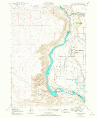
1950 Map of Gooding Butte
USGS Topo · Published 1993About this map
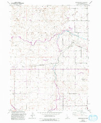
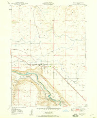
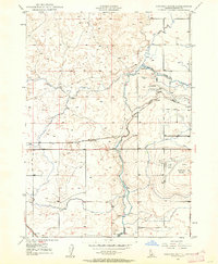
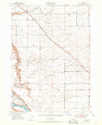
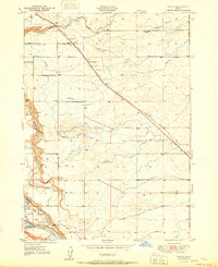
The confluence of the Big Wood River and the Little Wood River creates a complex hydrologic landscape in this mid-century Idaho survey. Agricultural development is evident through the extensive reach of the Gooding Canal and smaller infrastructure like the Tea Kettle Reservoir and Rocky Reservoir. The settlement of Gooding serves as a local hub, supported by the Gooding Municipal Airport and transportation routes like Main Road. The terrain is punctuated by volcanic and water-carved features, most notably the prominent Gooding Butte and the winding course of the Malad River. This map captures the intersection of irrigation engineering and natural water systems, including specific utilities like the Powerhouse, various Storage Bins, and the Gaging Sta along the riverbanks. Localized markers like Walker Waterhole and Fuller provide additional context for rural life in the Snake River Plain region.
Find a feature on this map
26 named features on this map. Tap any name to fly to it.
Don’t see what you’re looking for? This feature index may not catch every label — zoom into the map to look around manually.
Map Details
Editions of this 1950 Gooding Butte Map
2 editions found
Other maps of this area
1949 · Bliss
USGS Topo · 1:24,000
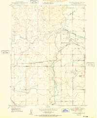
1949 · Gooding Butte
USGS Topo · 1:24,000
1949 · Tuttle
USGS Topo · 1:24,000
1949 · Hagerman
USGS Topo · 1:24,000
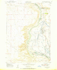
1950 · Gooding Butte
USGS Topo · 1:24,000
1950 · Hagerman
USGS Topo · 1:24,000
1950 · Bliss
USGS Topo · 1:24,000
1951 · Tuttle
USGS Topo · 1:24,000

1955 · Twin Falls
USGS Topo · 1:250,000

1955 · Hailey
USGS Topo · 1:250,000