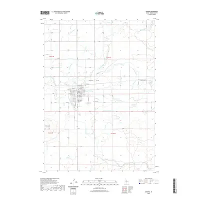
2020 Map of Gooding
USGS Topo · Published 2020About this map
Gooding sits at the heart of a highly engineered agricultural landscape where the Big Wood River and Little Wood River converge. This 2020 survey illustrates the sophisticated irrigation network of the Snake River Plain, defined by features like the S Gooding Main Canal, Boorman Ditch, and numerous laterals such as Lateral 3316 and Lateral 1465. The town itself is well-developed with institutional landmarks including the Gooding County Courthouse and the College of Southern Idaho - North Side Center. To the south, the terrain rises toward the distinct volcanic profile of Gooding Butte. For those researching local history, the map preserves the locations of two burial sites, Pioneer Cem and Elmwood Cem, alongside early water management infrastructure like the Gooding City Overflow.
Find a feature on this map
66 named features on this map. Tap any name to fly to it.
Don’t see what you’re looking for? This feature index may not catch every label — zoom into the map to look around manually.
Map Details
Editions of this 2020 Gooding Map
This is the sole edition of this map. No revisions or reprints were ever made.
Other maps of this area

1949 · Gooding Butte
USGS Topo · 1:24,000

1949 · Tuttle
USGS Topo · 1:24,000

1950 · Gooding Butte
USGS Topo · 1:24,000

1951 · Tuttle
USGS Topo · 1:24,000

1955 · Twin Falls
USGS Topo · 1:250,000

1955 · Hailey
USGS Topo · 1:250,000

1957 · Thorn Creek SE
USGS Topo · 1:24,000

1957 · Thorn Creek SW
USGS Topo · 1:24,000

1957 · Thorn Creek
USGS Topo · 1:62,500

1957 · Davis Mountain
USGS Topo · 1:62,500