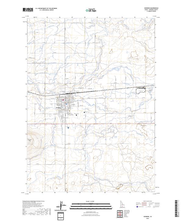
2024 Map of Gooding
USGS Topo · Published 2024About this map
Gooding serves as the focal point of this Southern Idaho landscape, situated at the confluence of an extensive hydraulic network designed for high-desert agriculture. The city's organized grid is anchored by the Gooding County Courthouse and the College of Southern Idaho - North Side Center, reflecting its role as a regional administrative and educational hub. Beyond the residential streets, the terrain is defined by the convergence of the Big Wood River and the Little Wood River, which are supplemented by an intricate system of man-made waterways such as the South Gooding Main Canal, Union Ditch, and Poorman Ditch. To the west, the volcanic geology of the Snake River Plain is evident at Gooding Butte, while local heritage is preserved at Pioneer Cem and Elmwood Cem. The map illustrates a landscape where natural watercourses like Clover Creek have been heavily modified to support the surrounding rural economy.
Find a feature on this map
99 named features on this map. Tap any name to fly to it.
Don’t see what you’re looking for? This feature index may not catch every label — zoom into the map to look around manually.
Map Details
Editions of this 2024 Gooding Map
This is the sole edition of this map. No revisions or reprints were ever made.
Other maps of this area

1949 · Gooding Butte
USGS Topo · 1:24,000

1949 · Tuttle
USGS Topo · 1:24,000

1950 · Gooding Butte
USGS Topo · 1:24,000

1951 · Tuttle
USGS Topo · 1:24,000

1955 · Twin Falls
USGS Topo · 1:250,000

1955 · Hailey
USGS Topo · 1:250,000

1957 · Thorn Creek SE
USGS Topo · 1:24,000

1957 · Thorn Creek SW
USGS Topo · 1:24,000

1957 · Thorn Creek
USGS Topo · 1:62,500

1957 · Davis Mountain
USGS Topo · 1:62,500