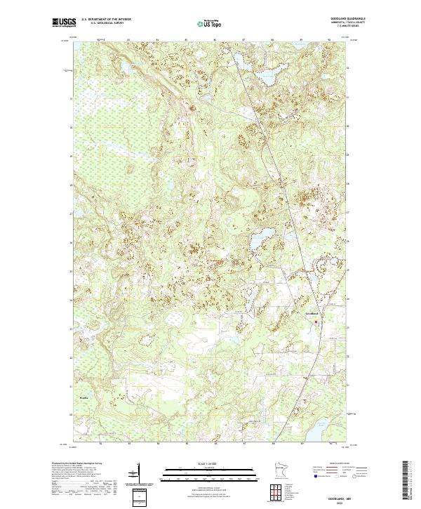
2022 Map of Goodland
USGS Topo · Published 2022About this map
Goodland sits as a primary settlement within this northern Minnesota landscape, where the terrain is defined by a dense network of glacial lakes and wetlands. The community is connected to the surrounding countryside by a web of local routes including the Goodland Trl and Co Rd 577. To the southwest, the village of Warba marks the edge of the survey area. The hydrography of the region is notably intricate, featuring prominent water bodies such as Twin Lake, Rosholt Lake, and the distinctly named Pancake Lake. These waters feed into systems like the W Br Floodwood River and Bruce Cr. Forested areas are accessible via timber and recreation routes like the Feeley Unit Forest Rd, reflecting the area's dual character of residential clusters and wilderness management typical of Itasca County.
Find a feature on this map
41 named features on this map. Tap any name to fly to it.
Don’t see what you’re looking for? This feature index may not catch every label — zoom into the map to look around manually.
Map Details
Editions of this 2022 Goodland Map
This is the sole edition of this map. No revisions or reprints were ever made.
Other maps of this area

1920 · Trout Lake
USGS Topo · 1:62,500

1952 · Silica
USGS Topo · 1:24,000

1952 · Calumet
USGS Topo · 1:24,000

1952 · Pengilly
USGS Topo · 1:24,000

1954 · Hibbing
USGS Topo · 1:250,000

1957 · Hibbing
USGS Topo · 1:250,000

1958 · Hibbing
USGS Topo · 1:250,000

1964 · Hibbing
USGS Topo · 1:250,000

1969 · Wawina
USGS Topo · 1:24,000
1969 · Floodwood Lake
USGS Topo · 1:24,000