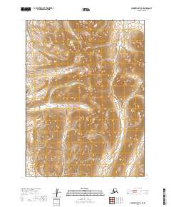
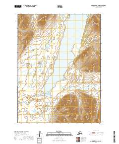
2019 Map of Goodnews Bay C-3 NE
USGS Topo · Published 2019About this map
Atshichlut Mtn stands as the central landmark in this high-elevation Alaskan landscape, part of a rugged interior region within the Dillingham Census Area. The terrain is defined by the drainage patterns of the Kemuk River, which flows southward through the eastern portion of the quadrangle. Smaller watercourses like Gemuk Cr in the north and Kipnuktuli Cr in the southeast carve through the steep contour intervals, illustrating a wilderness environment largely devoid of human infrastructure. The presence of township and range boundaries such as t5s r62w and t6s r63w indicates the systematic surveying of this remote territory, providing a precise spatial framework for land management in a region where natural features serve as the primary navigational markers.
Find a feature on this map
8 named features on this map. Tap any name to fly to it.
Don’t see what you’re looking for? This feature index may not catch every label — zoom into the map to look around manually.
Map Details
Editions of this 2019 Goodnews Bay C-3 NE Map
This is the sole edition of this map. No revisions or reprints were ever made.
Other maps of this area

1951 · Goodnews
USGS Topo · 1:250,000

1954 · Goodnews C-2
USGS Topo · 1:63,360

1979 · Goodnews Bay D-3
USGS Topo · 1:63,360

1979 · Goodnews Bay C-3
USGS Topo · 1:63,360

1979 · Goodnews Bay
USGS Topo · 1:250,000

1979 · Goodnews Bay D-2
USGS Topo · 1:63,360
2019 · Goodnews Bay C-3 SE
USGS Topo · 1:25,000
2019 · Goodnews Bay D-3 SE
USGS Topo · 1:25,000
2019 · Goodnews Bay C-3 NW
USGS Topo · 1:25,000
2019 · Goodnews Bay C-2 SW
USGS Topo · 1:25,000