
1979 Map of Goodnews Bay C-3
USGS Topo · Published 1979About this map
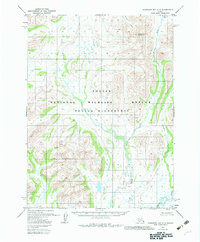
Togiak River drainage dominates the southeastern reaches of this remote landscape, where the confluence of several major waterways defines the natural transport corridors of the region. Steep terrain rises sharply from the riverbanks toward peaks like Atshichlut Mountain, while the northern portion of the map is marked by the presence of Nenevok Lake. The network of Gemuk Creek and the Kemuk River creates an intricate system of tributaries that transition from high mountain runoff into the broader valley floors. This 1970s survey, compiled from aerial photography taken in 1973, captures the unmodified hydrology of the area before modern infrastructure arrived. Researchers studying the traditional land use of the Dillingham region can trace the natural paths of Kipnuktuli Creek and other waterways that have historically served as the primary means of movement through this wilderness.
Find a feature on this map
6 named features on this map. Tap any name to fly to it.
Don’t see what you’re looking for? This feature index may not catch every label — zoom into the map to look around manually.
Map Details
Editions of this 1979 Goodnews Bay C-3 Map
2 editions found
Other maps of this area

1951 · Goodnews
USGS Topo · 1:250,000

1954 · Goodnews B-3
USGS Topo · 1:63,360

1954 · Goodnews C-2
USGS Topo · 1:63,360

1954 · Goodnews C-4
USGS Topo · 1:63,360

1954 · Goodnews D-4
USGS Topo · 1:63,360

1979 · Goodnews Bay D-3
USGS Topo · 1:63,360

1979 · Goodnews Bay B-2
USGS Topo · 1:63,360

1979 · Goodnews Bay
USGS Topo · 1:250,000

1979 · Goodnews Bay D-2
USGS Topo · 1:63,360
1979 · Goodnews Bay B-4
USGS Topo · 1:63,360