
1979 Map of Goodnews Bay B-2
USGS Topo · Published 1979About this map
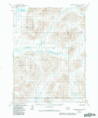
Togiak River drainage systems dominate this late-1970s landscape in southwest Alaska, revealing a complex network of glacial valleys and alpine basins. The topographical data, compiled from mid-decade aerial photography, captures a terrain defined by its intricate hydrology rather than human settlement. The Ongivinuck River and the curiously named No Lake Creek wind through deep mountain passes, illustrating the natural drainage patterns that have shaped this roadless region for millennia. In the southern portion of the quadrangle, the Kulukak River and Ongoke River gather from numerous unnamed tributaries, highlighting the density of the freshwater network. This survey remains an essential reference for understanding the landforms of the Dillingham area before subsequent environmental shifts, providing a precise record of watercourses and elevation contours across this uninhabited wilderness.
Find a feature on this map
5 named features on this map. Tap any name to fly to it.
Don’t see what you’re looking for? This feature index may not catch every label — zoom into the map to look around manually.
Map Details
Editions of this 1979 Goodnews Bay B-2 Map
2 editions found
Other maps of this area

1951 · Goodnews
USGS Topo · 1:250,000

1954 · Goodnews B-3
USGS Topo · 1:63,360

1954 · Goodnews C-2
USGS Topo · 1:63,360

1954 · Goodnews A-3
USGS Topo · 1:63,360
1979 · Goodnews Bay A-1
USGS Topo · 1:63,360

1979 · Goodnews Bay C-3
USGS Topo · 1:63,360

1979 · Goodnews Bay B-1
USGS Topo · 1:63,360

1979 · Goodnews Bay
USGS Topo · 1:250,000

1979 · Goodnews Bay C-1
USGS Topo · 1:63,360
1979 · Goodnews Bay A-2
USGS Topo · 1:63,360