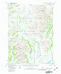
1979 Map of Goodnews Bay C-3
USGS Topo · Published 1983About this map
Togiak National Wildlife Refuge and the Togiak Wilderness dominate this interior Alaskan landscape, which was mapped shortly after the Alaska National Interest Lands Conservation Act established these federal reservations. The terrain is defined by the drainage systems of the Togiak River and the Kemuk River, which wind through a high-relief environment anchored by Atshichlut Mountain.
Find a feature on this map
9 named features on this map. Tap any name to fly to it.
Don’t see what you’re looking for? This feature index may not catch every label — zoom into the map to look around manually.
Map Details
Editions of this 1979 Goodnews Bay C-3 Map
2 editions found
Other maps of this area

1951 · Goodnews
USGS Topo · 1:250,000

1954 · Goodnews B-3
USGS Topo · 1:63,360

1954 · Goodnews C-2
USGS Topo · 1:63,360

1954 · Goodnews C-4
USGS Topo · 1:63,360

1954 · Goodnews D-4
USGS Topo · 1:63,360

1979 · Goodnews Bay D-3
USGS Topo · 1:63,360

1979 · Goodnews Bay B-2
USGS Topo · 1:63,360

1979 · Goodnews Bay C-3
USGS Topo · 1:63,360

1979 · Goodnews Bay
USGS Topo · 1:250,000

1979 · Goodnews Bay D-2
USGS Topo · 1:63,360