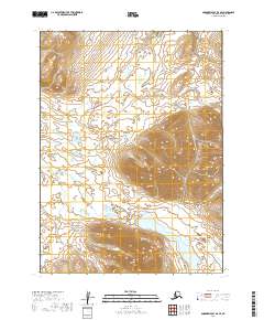
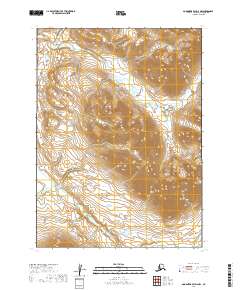
2019 Map of Goodnews Bay D-3 SE
USGS Topo · Published 2019About this map
The Ahklun Mountains dominate this high-latitude terrain within the Dillingham Census Area, characterized by steep elevations and glacial-fed drainage systems. Located in a remote portion of southwest Alaska, the map captures a landscape defined by significant water bodies such as Nenevok Lake and the winding course of Aukamunuk Cr. The survey illustrates the complex natural topography of the region, including the prominent peak of Kolchichet Mtn.
Find a feature on this map
11 named features on this map. Tap any name to fly to it.
Don’t see what you’re looking for? This feature index may not catch every label — zoom into the map to look around manually.
Map Details
Editions of this 2019 Goodnews Bay D-3 SE Map
This is the sole edition of this map. No revisions or reprints were ever made.
Other maps of this area

1951 · Goodnews
USGS Topo · 1:250,000

1954 · Goodnews C-2
USGS Topo · 1:63,360

1979 · Goodnews Bay D-3
USGS Topo · 1:63,360

1979 · Goodnews Bay C-3
USGS Topo · 1:63,360

1979 · Goodnews Bay
USGS Topo · 1:250,000

1979 · Goodnews Bay D-2
USGS Topo · 1:63,360
2019 · Goodnews Bay D-3 NE
USGS Topo · 1:25,000
2019 · Goodnews Bay D-3 NW
USGS Topo · 1:25,000
2019 · Goodnews Bay C-3 NW
USGS Topo · 1:25,000
2019 · Goodnews Bay D-2 NW
USGS Topo · 1:25,000