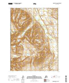
2019 Map of Goodnews Bay D-3 NE
USGS Topo · Published 2019About this map
Atayak Mountain rises in the southwestern corner of this survey, defining a landscape of high-elevation contours and seasonal waterways. The terrain is deeply carved by drainage systems, most notably Trail Creek, which threads through the northeastern sections of the quadrangle. This area spans a remote boundary between the Bethel and Dillingham Census Areas, illustrating the transition across the Alaska interior where human settlements are absent and the topography is dictated by the natural watershed. The map records the precise Public Land Survey System divisions, including sections of Township 2 South, Range 62 West and Township 3 South, Range 61 West, providing a technical look at how this untamed land is legally partitioned for administrative oversight.
Find a feature on this map
7 named features on this map. Tap any name to fly to it.
Don’t see what you’re looking for? This feature index may not catch every label — zoom into the map to look around manually.
Map Details
Editions of this 2019 Goodnews Bay D-3 NE Map
This is the sole edition of this map. No revisions or reprints were ever made.
Other maps of this area

1950 · Bethel
USGS Topo · 1:250,000

1951 · Goodnews
USGS Topo · 1:250,000

1979 · Bethel A-3
USGS Topo · 1:63,360

1979 · Goodnews Bay D-3
USGS Topo · 1:63,360

1979 · Bethel A-2
USGS Topo · 1:63,360

1979 · Goodnews Bay
USGS Topo · 1:250,000

1979 · Goodnews Bay D-2
USGS Topo · 1:63,360

1980 · Bethel
USGS Topo · 1:250,000
2019 · Goodnews Bay D-3 SE
USGS Topo · 1:25,000
2019 · Bethel A-3 SE
USGS Topo · 1:25,000