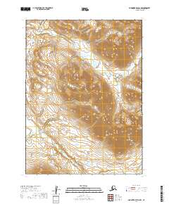
2019 Map of Goodnews Bay D-2 NW
USGS Topo · Published 2019About this map
Trail Creek defines the hydrological character of this high-elevation Alaskan landscape, its various branches carving through several townships in the Goodnews Bay region. The 2019 survey documents a wilderness area largely defined by its intricate drainage patterns rather than human habitation, showing the rugged relief of the Dillingham Census Area through sharp contour intervals. The orientation of Trail Creek through t2s r61w, t2s r60w, and t3s r61w reveals the natural corridors of the Ahklun Mountains, providing essential data for those studying the remote geography of Southwest Alaska.
Find a feature on this map
5 named features on this map. Tap any name to fly to it.
Don’t see what you’re looking for? This feature index may not catch every label — zoom into the map to look around manually.
Map Details
Editions of this 2019 Goodnews Bay D-2 NW Map
This is the sole edition of this map. No revisions or reprints were ever made.
Other maps of this area

1950 · Bethel
USGS Topo · 1:250,000

1951 · Goodnews
USGS Topo · 1:250,000

1979 · Bethel A-3
USGS Topo · 1:63,360

1979 · Goodnews Bay D-3
USGS Topo · 1:63,360

1979 · Bethel A-2
USGS Topo · 1:63,360

1979 · Goodnews Bay
USGS Topo · 1:250,000

1979 · Goodnews Bay D-2
USGS Topo · 1:63,360

1980 · Bethel
USGS Topo · 1:250,000
2019 · Goodnews Bay D-3 NE
USGS Topo · 1:25,000
2019 · Goodnews Bay D-3 SE
USGS Topo · 1:25,000