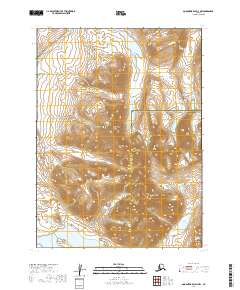
2019 Map of Goodnews Bay D-3 NW
USGS Topo · Published 2019About this map
The Ouchklune Range dominates this corner of the Alaska wilderness, where the high peaks of Mt Oratia and Outuchiwenat Mtn rise above a complex network of glacial valleys. This 2019 survey documents the headwaters and drainage patterns of the Eek River, which winds through the northern sections of the map. To the south, the terrain descends toward large freshwater bodies, including the northern portions of Kagati Lake and the smaller Pegati Lake. The map illustrates the boundary between the Bethel Census Area and Dillingham Census Area, highlighting the remote nature of this region. The lack of roads or established settlements emphasizes the reliance on natural waterways like Armugiak Cr for movement through the interior during this era.
Find a feature on this map
12 named features on this map. Tap any name to fly to it.
Don’t see what you’re looking for? This feature index may not catch every label — zoom into the map to look around manually.
Map Details
Editions of this 2019 Goodnews Bay D-3 NW Map
This is the sole edition of this map. No revisions or reprints were ever made.
Other maps of this area

1950 · Bethel
USGS Topo · 1:250,000

1951 · Goodnews
USGS Topo · 1:250,000

1954 · Bethel A-4
USGS Topo · 1:63,360

1954 · Goodnews D-4
USGS Topo · 1:63,360

1979 · Bethel A-3
USGS Topo · 1:63,360

1979 · Goodnews Bay D-3
USGS Topo · 1:63,360

1979 · Goodnews Bay
USGS Topo · 1:250,000

1980 · Bethel
USGS Topo · 1:250,000
2017 · Bethel A-4 SE
USGS Topo · 1:25,000
2019 · Goodnews Bay D-3 NE
USGS Topo · 1:25,000