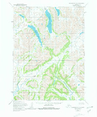
1954 Map of Goodnews Bay C-4
USGS Topo · Published 1981About this map
Nagugun Lake and its surrounding drainage basin define this glacial landscape in southwestern Alaska, as documented during the mid-1950s. The region is dominated by a trio of significant water bodies, including Klak Lake and Kanuktik Lake, which serve as the headwaters for a complex network of streams and rivers. These waters eventually feed into the Goodnews River and the Iamiuwanik River, carving paths through the high terrain marked by Mitlak Mountain and Nigag Mountain.
Find a feature on this map
11 named features on this map. Tap any name to fly to it.
Don’t see what you’re looking for? This feature index may not catch every label — zoom into the map to look around manually.
Map Details
Editions of this 1954 Goodnews Bay C-4 Map
2 editions found
Other maps of this area

1951 · Goodnews
USGS Topo · 1:250,000

1954 · Goodnews B-3
USGS Topo · 1:63,360

1954 · Goodnews C-4
USGS Topo · 1:63,360

1954 · Goodnews D-4
USGS Topo · 1:63,360

1954 · Goodnews D-5
USGS Topo · 1:63,360

1979 · Goodnews Bay C-5
USGS Topo · 1:63,360

1979 · Goodnews Bay D-3
USGS Topo · 1:63,360

1979 · Goodnews Bay B-5
USGS Topo · 1:63,360

1979 · Goodnews Bay C-3
USGS Topo · 1:63,360

1979 · Goodnews Bay
USGS Topo · 1:250,000