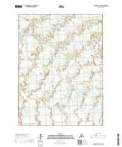
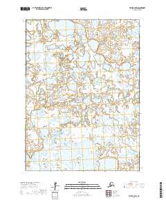
2017 Map of Goodnews Bay D-8 NE
USGS Topo · Published 2017About this map
Kuskokwak Cr and Tungak Cr wind through a complex network of wetlands and small lakes in this part of the Bethel Census Area. The landscape is defined by its extensive water systems, where narrow channels and broad pools dominate the terrain between the survey lines of t2s r73w, t2s r72w, t3s r73w, and t3s r72w. This 2017 study reflects a wilderness environment where natural drainage patterns and the seasonal shift of water bodies are the primary features, showing no major roads or permanent settlements within these particular township boundaries. The lack of human infrastructure emphasizes the map's value for understanding the hydrology and undisturbed land patterns of this subarctic region.
Find a feature on this map
6 named features on this map. Tap any name to fly to it.
Don’t see what you’re looking for? This feature index may not catch every label — zoom into the map to look around manually.
Map Details
Editions of this 2017 Goodnews Bay D-8 NE Map
This is the sole edition of this map. No revisions or reprints were ever made.
Other maps of this area

1950 · Bethel
USGS Topo · 1:250,000

1951 · Goodnews
USGS Topo · 1:250,000
1954 · Bethel A-8
USGS Topo · 1:63,360

1954 · Bethel A-7
USGS Topo · 1:63,360

1954 · Goodnews D-7
USGS Topo · 1:63,360
1954 · Goodnews D-8
USGS Topo · 1:63,360

1979 · Goodnews Bay
USGS Topo · 1:250,000

1980 · Bethel
USGS Topo · 1:250,000
2017 · Bethel A-7 SW
USGS Topo · 1:25,000
2017 · Bethel A-8 SW
USGS Topo · 1:25,000