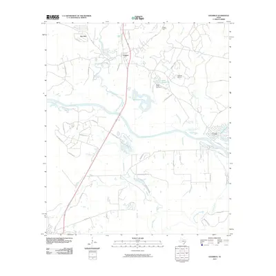
2010 Map of Goodrich
USGS Topo · Published 2010About this map
Goodrich and New Hope serve as the primary settlement hubs in this San Jacinto County landscape, where the wide Trinity River meanders through a complex network of wetlands and tributaries. The geography is defined by its water management and industry, featuring the Morgan Creek Oil Field to the north and various artificial reservoirs like Sleepy Hollow Lake and Lake Londa Lynn, both secured by their respective dams. The map reveals a rural economy shaped by ranching and local transport, evidenced by the Rocking P Arena and Loghouse Stolport.
Find a feature on this map
54 named features on this map. Tap any name to fly to it.
Don’t see what you’re looking for? This feature index may not catch every label — zoom into the map to look around manually.
Map Details
Editions of this 2010 Goodrich Map
This is the sole edition of this map. No revisions or reprints were ever made.
Other maps of this area

1943 · Liberty
USGS Topo · 1:125,000

1954 · Beaumont
USGS Topo · 1:250,000

1955 · Rayburn
USGS Topo · 1:62,500

1957 · Beaumont
USGS Topo · 1:250,000

1958 · Westcott
USGS Topo · 1:24,000

1958 · Livingston
USGS Topo · 1:62,500

1960 · Blanchard
USGS Topo · 1:24,000

1960 · Camilla
USGS Topo · 1:24,000

1984 · Soda
USGS Topo · 1:24,000

1984 · Beaumont
USGS Topo · 1:250,000