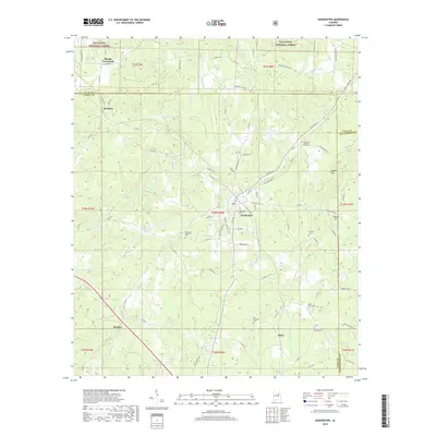
2018 Map of Goodwater
USGS Topo · Published 2018About this map
Goodwater serves as the primary hub in this Coosa County landscape, situated where the northern reaches of the Talladega National Forest meet agricultural and timber lands. The settlement pattern is defined by several smaller crossroads and communities, including Skeggs Crossroads, Parkdale, Hatchet, and Soleo, each anchored by a network of county roads and family-named routes like Brownsville Loop. Significant genealogical data is present through numerous burial sites such as Old Marietta Cem and Martin Grove Cem, reflecting the area's long-standing rural church and family heritage.
Find a feature on this map
96 named features on this map. Tap any name to fly to it.
Don’t see what you’re looking for? This feature index may not catch every label — zoom into the map to look around manually.
Map Details
Editions of this 2018 Goodwater Map
This is the sole edition of this map. No revisions or reprints were ever made.
Other maps of this area

1890 · Talladega
USGS Topo · 1:125,000

1891 · Ashland
USGS Topo · 1:125,000

1892 · Talladega
USGS Topo · 1:125,000

1901 · Wetumpka
USGS Topo · 1:125,000

1903 · Wetumpka
USGS Topo · 1:125,000

1906 · Dadeville
USGS Topo · 1:125,000

1944 · Goodwater
USGS Topo · 1:62,500

1947 · Goodwater
USGS Topo · 1:62,500

1953 · Montgomery
USGS Topo · 1:250,000

1953 · Birmingham
USGS Topo · 1:250,000