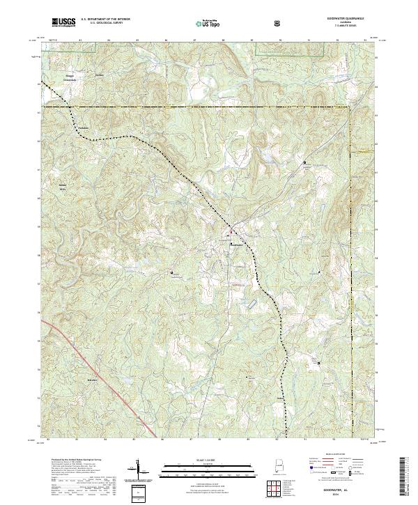
2024 Map of Goodwater
USGS Topo · Published 2024About this map
Goodwater serves as the central hub of this survey, where the intersection of Hackneyville St and S Main St anchors the local settlement. The landscape is defined by the headwaters of Hatchet Creek and Socapatoy Creek, with the northern reaches protected by the Talladega National Forest. A notable concentration of small, family-named landmarks and cemeteries, such as Crestview Memorial Cem and Martin Grove Cem, suggests a long-standing rural community structure. To the west, the crossroads of Skeggs Crossroads and the settlement of Hollins mark the transition toward the higher ground near Mount Olive. The inclusion of private impoundments like Griffin Harris Lake and Peoples Lake Number 2 alongside natural drainages like Wildcat Creek illustrates the modern water management patterns in this section of Coosa County.
Find a feature on this map
93 named features on this map. Tap any name to fly to it.
Don’t see what you’re looking for? This feature index may not catch every label — zoom into the map to look around manually.
Map Details
Editions of this 2024 Goodwater Map
This is the sole edition of this map. No revisions or reprints were ever made.
Other maps of this area

1890 · Talladega
USGS Topo · 1:125,000

1891 · Ashland
USGS Topo · 1:125,000

1892 · Talladega
USGS Topo · 1:125,000

1901 · Wetumpka
USGS Topo · 1:125,000

1903 · Wetumpka
USGS Topo · 1:125,000

1906 · Dadeville
USGS Topo · 1:125,000

1944 · Goodwater
USGS Topo · 1:62,500

1947 · Goodwater
USGS Topo · 1:62,500

1953 · Montgomery
USGS Topo · 1:250,000

1953 · Birmingham
USGS Topo · 1:250,000