
1947 Map of Goodwater
USGS Topo · Published 1947About this map
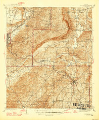
Goodwater and the surrounding pine-forested ridges of the Talladega National Forest define the landscape of east-central Alabama just after World War II. The terrain is marked by the steep relief of Talladega Mountain, with the Hollins Fire Tower standing as a sentinel over the wooded slopes. This era of rural development is reflected in the distribution of family and community nodes, such as Liberty Hill Sch and Marvin Chapel, connected by early thoroughfares like the Wiregrass Road.
Find a feature on this map
55 named features on this map. Tap any name to fly to it.
Don’t see what you’re looking for? This feature index may not catch every label — zoom into the map to look around manually.
Map Details
Editions of this 1947 Goodwater Map
2 editions found
Other maps of this area

1890 · Talladega
USGS Topo · 1:125,000

1891 · Ashland
USGS Topo · 1:125,000

1892 · Talladega
USGS Topo · 1:125,000

1901 · Wetumpka
USGS Topo · 1:125,000

1903 · Wetumpka
USGS Topo · 1:125,000

1906 · Dadeville
USGS Topo · 1:125,000

1915 · Gantts Quarry
USGS Topo · 1:48,000

1917 · Gantts Quarry
USGS Topo · 1:62,500

1943 · Talladega
USGS Topo · 1:62,500

1944 · Goodwater
USGS Topo · 1:62,500