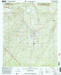
2001 Map of Goodwater
USGS Topo · Published 2004About this map
Goodwater serves as the focal point of this Coosa County landscape at the turn of the 21st century, where the Central of Georgia railroad line cuts through the center of town. The area is characterized by the winding path of Hatchet Creek and its many tributaries, including Wildcat Creek and Partridge Creek. Local community life is anchored by several rural landmarks such as Haynes Chapel, Smyrna Ch, and the Goodwater Academy.
Find a feature on this map
53 named features on this map. Tap any name to fly to it.
Don’t see what you’re looking for? This feature index may not catch every label — zoom into the map to look around manually.
Map Details
Editions of this 2001 Goodwater Map
This is the sole edition of this map. No revisions or reprints were ever made.
Other maps of this area

1890 · Talladega
USGS Topo · 1:125,000

1891 · Ashland
USGS Topo · 1:125,000

1892 · Talladega
USGS Topo · 1:125,000

1901 · Wetumpka
USGS Topo · 1:125,000

1903 · Wetumpka
USGS Topo · 1:125,000

1906 · Dadeville
USGS Topo · 1:125,000

1944 · Goodwater
USGS Topo · 1:62,500

1947 · Goodwater
USGS Topo · 1:62,500

1953 · Montgomery
USGS Topo · 1:250,000

1953 · Birmingham
USGS Topo · 1:250,000